APPLICATIONS OF REMOTE SENSING AND GIS IN DISASTER MANAGEMENT AND INTERNAL SECURITY - 1
Description
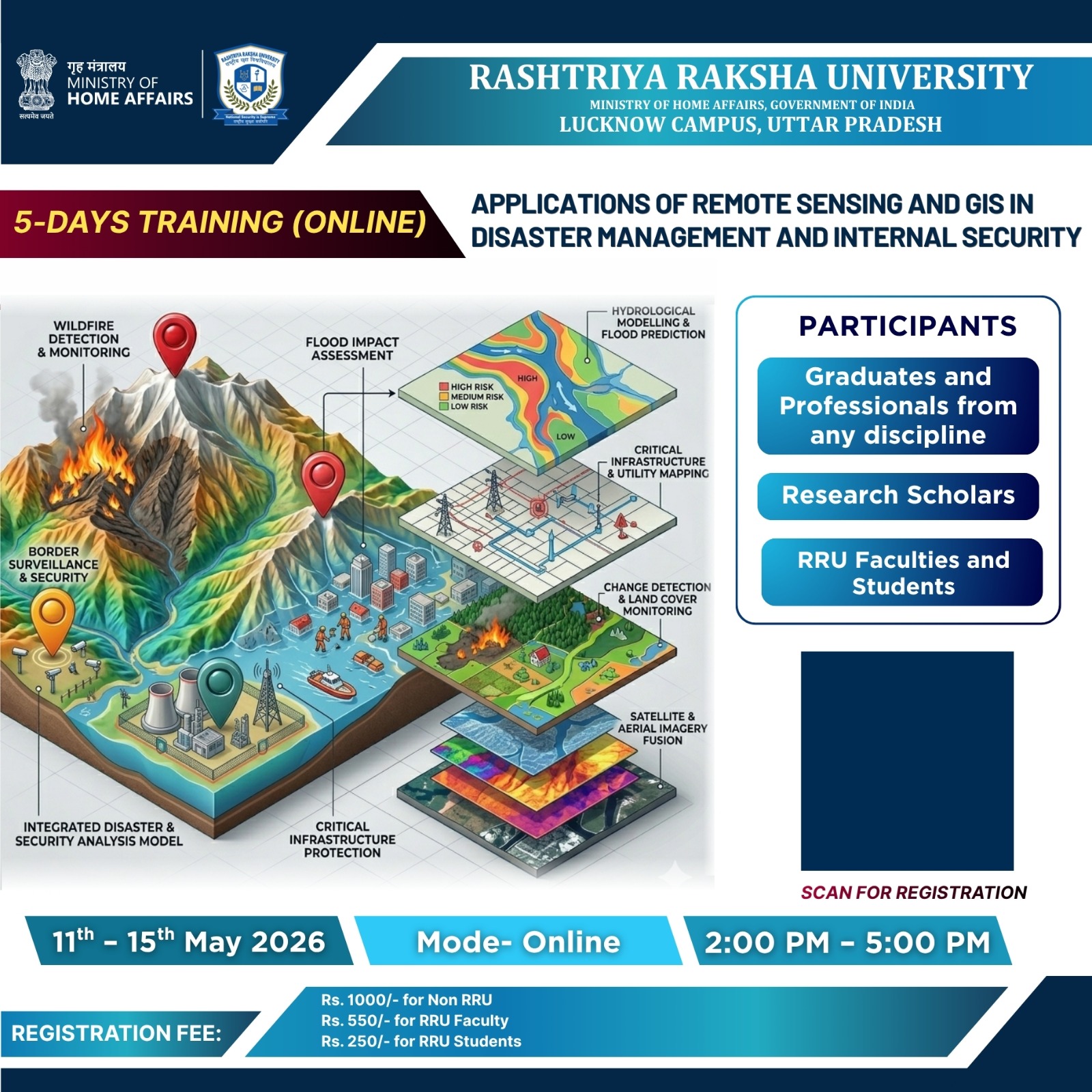
In the contemporary landscape of disaster management, the effective application of geospatial technologies has emerged as a critical enabler for preparedness, response, and recovery operations. Remote Sensing and Geographic Information Systems (GIS) provide powerful tools for hazard monitoring, damage assessment, evacuation planning, and post-disaster reconstruction, enabling security and disaster management professionals to make informed, data-driven decisions under pressure.
This five-day basic-level online training program on "Applications of Remote Sensing and GIS in Disaster Management and Internal Security" is being organized by Rashtriya Raksha University (RRU), Lucknow Campus, under the aegis of the Ministry of Home Affairs, Government of India. The program is designed to build foundational competency among participants in leveraging satellite imagery, GIS mapping, and spatial data analysis for disaster risk reduction and security management in disaster contexts.
The internal security dimension of this training specifically addresses security challenges that arise in the context of disasters including the management of relief camps, surveillance of disaster-affected zones, crowd and civil order management during emergencies, protection of critical infrastructure, and law enforcement coordination during multi-hazard events. Participants will explore how Remote Sensing and GIS tools can enhance situational awareness, support resource deployment, and strengthen inter-agency coordination for both disaster response and internal security operations.
The program will employ a blend of conceptual lectures, case studies, live demonstrations, and guided practical exercises, making it accessible and impactful for participants from diverse professional backgrounds. All sessions will be conducted by the faculty of the Disaster Management department, Rashtriya Raksha University, Lucknow Campus. By integrating technological skills with operational understanding, this training seeks to contribute to a more resilient and technology-enabled security-disaster management ecosystem.
What you'll learn
• Foundational Knowledge: Participants will gain a basic understanding of Remote Sensing and GIS technologies and their relevance to disaster management and internal security. • Operational Awareness: Enhanced ability to comprehend and use satellite-derived maps, hazard atlases, and GIS-based risk data in operational planning. • Security-Disaster Nexus: Understanding of how geospatial tools support internal security functions during disaster events, including surveillance, crowd management, and emergency law enforcement coordination. • Practical Skill Exposure: Familiarity with open-source GIS tools and satellite data platforms used in disaster monitoring and response. • Institutional Preparedness: Contribution to building a technology-literate workforce capable of integrating RS and GIS into disaster management and security frameworks.
Requirements
Course Content
 No Content Founds.
Semester with subjects
No Semester Founds.
Experts

Dr. Md Nawaj Sarif
Assistant Professor

Dr. Abhra Singh
Assistant Professor

Akanksha Pandey
Assistant Professor
Recent Reviews